 By
Wednesday night, I felt much better, and ready to tackle the
world, or at least a 750 mile section of it. So as a team, we
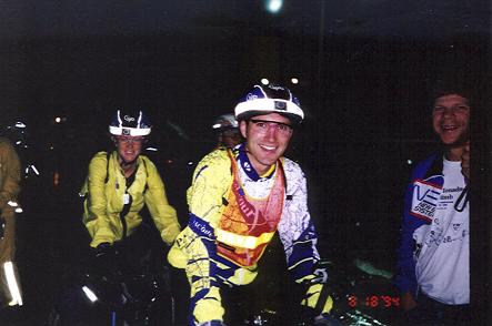
set out from Wellesley at 4 o'clock Thursday morning, with 100
other excited cyclists in a steady downpour. Jeff Vogel told
us it was the first time BMB had started in the rain. I knew
riders encountered a couple of days of rain in both 89 and 90,
but apparently we were the first to see it at the starting line.
Unfortunately it was also 62F degrees. I say unfortunate, because
this temperature renders my rain gear somewhat useless. It's
so warm that I steam up in rain gear, but still cool enough
that I need something. I chose to put up with the steam to avoid
getting chilled this early in a four days event, using rain
pants and jacket, while John went with tights and a light jacket.
We both opted for booties. At least this made our panniers lighter
! A scan of other riders revealed everything from shorts and
jerseys to full rain gear.
By
Wednesday night, I felt much better, and ready to tackle the
world, or at least a 750 mile section of it. So as a team, we
set out from Wellesley at 4 o'clock Thursday morning, with 100
other excited cyclists in a steady downpour. Jeff Vogel told
us it was the first time BMB had started in the rain. I knew
riders encountered a couple of days of rain in both 89 and 90,
but apparently we were the first to see it at the starting line.
Unfortunately it was also 62F degrees. I say unfortunate, because
this temperature renders my rain gear somewhat useless. It's
so warm that I steam up in rain gear, but still cool enough
that I need something. I chose to put up with the steam to avoid
getting chilled this early in a four days event, using rain
pants and jacket, while John went with tights and a light jacket.
We both opted for booties. At least this made our panniers lighter
! A scan of other riders revealed everything from shorts and
jerseys to full rain gear.
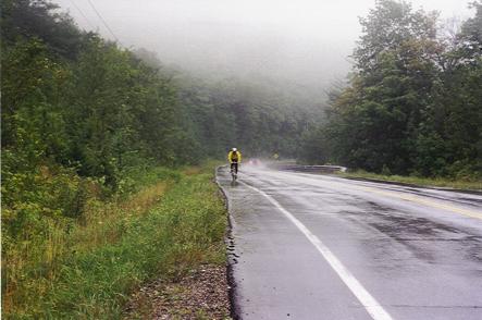
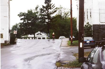
While driving over the first part of the course the night before,
we learned that construction crews had left us a little surprise
in the form of a mile's worth of raised manhole covers. I wanted
to be out front going through that section. And being one of
the very few bikes with fenders, I wanted to be out front in
hopes of staying a bit dryer. Amazingly, other riders seemed
quite content with the pace we set for the first 20 miles. The
rain flooded roads presented a fun obstacle course to pedal
or should that have been paddle through. Riders behind asked
us to warn them in advance about the puddles. Despite our very
powerful NiteRider headlights, we only sensed the presence of
deep puddles when the water sprayed our own feet. The mudflap
on the front fender definitely kept some of the spray down,
but I was happy to have my booties.
 Just
after we reached I-495, one of my cleats slipped. It slid completely
back on the shoe. Living in the area, we have a nice advantage
of knowing most of the route very well, and therefore we know
where stores are and aren't, and which ones might be open at
odd hours. We set our sites on the Dunkin Donuts in Clinton
to tighten the cleat and take care of other pressing matters.
The hills were about to start and I also decided to trade my
medium weight jacket for a lighter one.
Just
after we reached I-495, one of my cleats slipped. It slid completely
back on the shoe. Living in the area, we have a nice advantage
of knowing most of the route very well, and therefore we know
where stores are and aren't, and which ones might be open at
odd hours. We set our sites on the Dunkin Donuts in Clinton
to tighten the cleat and take care of other pressing matters.
The hills were about to start and I also decided to trade my
medium weight jacket for a lighter one.
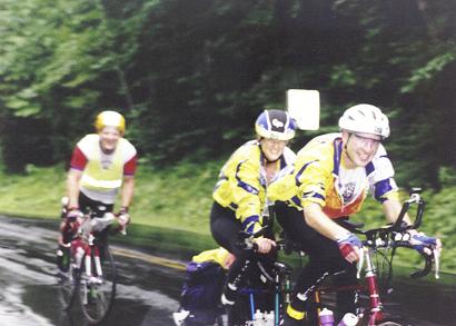
Ray Edwards, a friend from Atlanta, was keeping us company
at this point. Soon after the hills began, we bid farewell to
Ray, since it really can be a struggle for singles and tandems
to ride together in steep terrain, given their very different
behavior on hills. Ray would go onto finish the ride in a very
impressive 66 hours. We knew enough about what lay ahead of
us not to kill ourselves early !
 We
continued the march onward and upward toward Princeton. On a
clear day, one can see the outline of Boston's skyline ever
so faintly from the top of the hill in Princeton. That was definitely
not the case this drizzly Thursday morning.
We
continued the march onward and upward toward Princeton. On a
clear day, one can see the outline of Boston's skyline ever
so faintly from the top of the hill in Princeton. That was definitely
not the case this drizzly Thursday morning.
We soon found ourselves in the company of the Crones, the tandem
team we had met the night before. They were quite strong, and
I was immediately confident that they would break the old mixed
tandem record of 85.5 hours by quite a significant margin. John
and I had decided to go for my usual goal - have lots of fun,
get lots of sleep, lots of massages, and finish close to the
picnic starting time. We also planned to ride shorter and shorter
distances each day, aiming for 270 to Burlington, VT. the first
day, 210 to Montreal and back to Burlington on Day 2, 165 to
Brattleboro on day 3, and 113 back to Wellesley on the final
day. We had made reservations in Burlington and Brattleboro
to ensure good nights' sleep along the way, with the option
to cancel them if our plans changed. But we had quite a ways
to go first.
 We
saw a BMB official vehicle pulled over on the shoulder just
after we turned onto Route 68. Since, John and I had suffered
a couple of flats on our rainy 400K ride on this particular
stretch of road, we were purposefully staying off the shoulder.
When we first saw the vehicle pulled over to the side, I thought
for sure that others were suffering the same fate we had earlier,
but instead, it was simply a secret control. Each rider starts
out with a passport-like card, with squares to be stamped at
announced controls along the route. There are 5 controls each
way, plus the turnaround and start/finish. The vary from 37
to 85 miles apart. Riders have to check in, and get their cards
stamped along the way. Then there are secret controls which
can appear at any point along the route. These are designed
to deter riders from taking shortcuts. This secret control would
catch any rider that stayed on Route 62 - the old route - although
given the roughness of that road, and the superior road surface
of the new route I can't imagine anyone wanting to do so.
We
saw a BMB official vehicle pulled over on the shoulder just
after we turned onto Route 68. Since, John and I had suffered
a couple of flats on our rainy 400K ride on this particular
stretch of road, we were purposefully staying off the shoulder.
When we first saw the vehicle pulled over to the side, I thought
for sure that others were suffering the same fate we had earlier,
but instead, it was simply a secret control. Each rider starts
out with a passport-like card, with squares to be stamped at
announced controls along the route. There are 5 controls each
way, plus the turnaround and start/finish. The vary from 37
to 85 miles apart. Riders have to check in, and get their cards
stamped along the way. Then there are secret controls which
can appear at any point along the route. These are designed
to deter riders from taking shortcuts. This secret control would
catch any rider that stayed on Route 62 - the old route - although
given the roughness of that road, and the superior road surface
of the new route I can't imagine anyone wanting to do so.
We pressed on through some good "fifty-five" rollers
on the way to Barre. By this, I mean hills where a tandem breaks
50 going down and struggles not to drop below 5 going up. For
some sadistic reason, this section of road gets covered five
times in our brevet series. Locals know it all too well. This
section of road can be quite discouraging to BMB newcomers,
especially the final climb into Barre, which is probably the
steepest climb of the entire course. Many riders use their lowest
gears to reach this town that I have determined must be the
center of the cycling universe, since so many rides in this
area pass through it.