
by Pamela
Blalock with photos by Steve Frechette
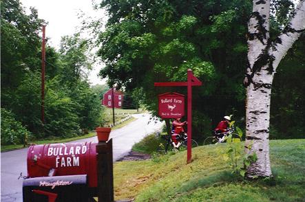
Bullard Farm
 The
first normal control was at a B&B in North New Salem. We
saw many other riders there, who were enjoying the abundant
food set out by the BMB staff, taking the opportunity to dry
out a bit, change clothes, etc. Terry Zmrhal, a friend of ours
from Seattle, who had volunteered to work a control after doing
the event last year, was working this checkpoint. We chatted
with him briefly, as well as many folks from our club, the Charles
River Wheelman, who were also doing the ride. A break in the
rain convinced me to pack away my rainpants and go with legwarmers,
and light jacket for a while. The
first normal control was at a B&B in North New Salem. We
saw many other riders there, who were enjoying the abundant
food set out by the BMB staff, taking the opportunity to dry
out a bit, change clothes, etc. Terry Zmrhal, a friend of ours
from Seattle, who had volunteered to work a control after doing
the event last year, was working this checkpoint. We chatted
with him briefly, as well as many folks from our club, the Charles
River Wheelman, who were also doing the ride. A break in the
rain convinced me to pack away my rainpants and go with legwarmers,
and light jacket for a while.
We managed to climb and descend Grace Mountain, crossing into
the state of New Hampshire before the drizzle started back up.
We passed our first covered bridge on route 119, just before
taking the very sharp and steep right hand turn that signals
the beginning of the first major climb of the ride, up Mt. Pisgah.
We rode with Woody, a rider we had met on the 600K, along this
section. The rain resumed, but chatting away, we soon reached
Route 9, and the descent down to the Connecticut River, which
serves as a border between NH and Vermont. Just across the river,
we pulled into the second checkpoint in Brattleboro, just as
the rain stopped again.
Brattleboro
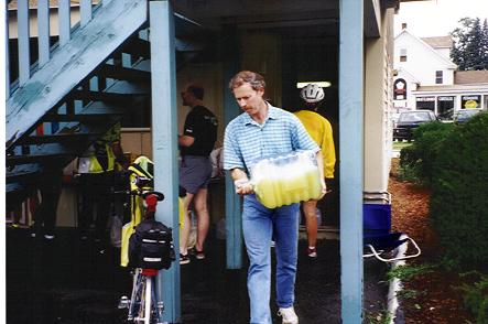 We
had sag bags here, so we restocked our liquid nutrition, Ensure
Plus, and I changed into a dry pair of shorts. The absence of
rain probably wouldn't last long, but I had packed lots of extra
clothes, so I took advantage of the chance to change. We
had sag bags here, so we restocked our liquid nutrition, Ensure
Plus, and I changed into a dry pair of shorts. The absence of
rain probably wouldn't last long, but I had packed lots of extra
clothes, so I took advantage of the chance to change.
The route to the next checkpoint is said to include two major
climbs, but BMB veterans know that there are really 4,
and that this is the toughest segment of the route. We left
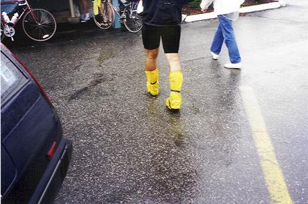
Brattleboro under dry skies, but within 10 miles, the heavens
opened and the rains came down hard. As stoker, on a bike with
fenders, I really don't mind riding in the rain. In fact, I
usually enjoy it. I don't have to worry about seeing where I'm
going, and John blocks a lot of the rain from the front. Of
course, John may have a different opinion about the matter.
We continued on, climbing to Westminster West, climbing a long
series of rollers on route 35, climbing past the switchback
to Andover Ridge, and finally climbing Terrible Mountain. We
also did some descending, and managed to comfortably hit 57.5
mph coming off both Andover and Terrible. The tandem is incredibly
stable at speed, and while the wet roads had us a bit more cautious
(we normally would break 60 easily), we were able to just let
the bike go. While the climbs may make this a tandem unfriendly
route, the descents definitely make up for it. For every climb,
we were rewarded fabulously with a thrilling descent.
 Noting
exactly where the switchback is on Andover can be very important
for the return trip. Since we might return in the dark, we wanted
a good idea of where we could let the bike fly, and where we
needed to exercise more caution. I took note of various landmarks
and mileage here. Switchbacks are pretty rare in New England.
There is one in Massachusetts, that is simply referred to a
the switchback. Most of the climbs in this area are straight
up, straight down, with a few curves thrown in. This makes for
great fast tandem descents, and long slow tandem ascents. Noting
exactly where the switchback is on Andover can be very important
for the return trip. Since we might return in the dark, we wanted
a good idea of where we could let the bike fly, and where we
needed to exercise more caution. I took note of various landmarks
and mileage here. Switchbacks are pretty rare in New England.
There is one in Massachusetts, that is simply referred to a
the switchback. Most of the climbs in this area are straight
up, straight down, with a few curves thrown in. This makes for
great fast tandem descents, and long slow tandem ascents.
|


